The Landscape and Visual Impact Assessment looks at the potential visual and landscape impacts on publicly accessible locations within the study area and private residential dwellings within 6 kilometres of a wind turbine.
The study area is based on the distance over which the proposed wind turbines have the potential to be readily perceptible in views – which is 28.6 kilometres. It may be possible to see the wind turbines from further away, however at a greater distance they would not be conspicuous.
To establish the potential visual impacts on the existing landscape the following steps were completed:
The relevant legislation and government policies that were considered in the preparation of the landscape and visual impact assessment are:

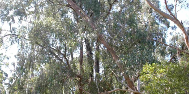
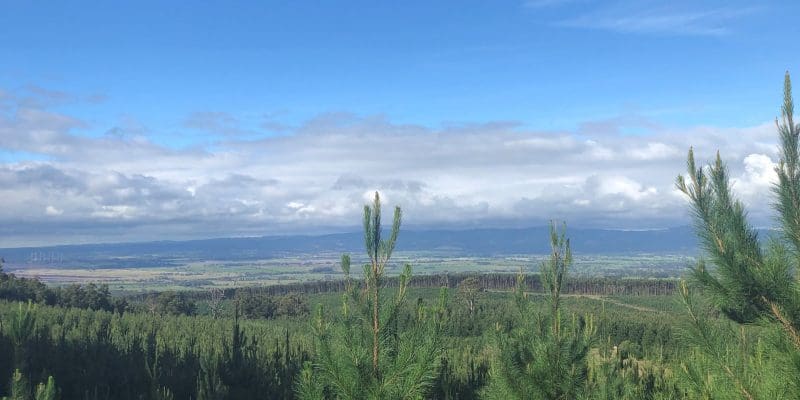
The study area includes parts of the Strzelecki Ranges, comprising rolling hills that range in elevation from 25 metres to 740 metres. Vegetation within the viewshed is varied and includes pine plantation immediately surrounding the site, natural forested areas, roadside vegetation, windbreak/buffer planting within farm areas and garden planting around residences.
Areas of visual / landscape sensitivity within the study area / viewshed includes:
It is noted that the majority of land within the viewshed is zoned Farming Zone (FZ) and Special Use Zone – Schedule 1 (SUZ1) which are not considered to be sensitive areas.
There are six different landscape unit types in the area surrounding the proposed Delburn Wind Farm which have been assessed based on land use, topography and vegetation. The landscape sensitivity of these units is established by taking into consideration the ability of a landscape to absorb visual change based on its current character, its location, the rarity of a particular landscape and the scenic qualities of a particular landscape.
The six identified landscape units and their associated sensitivity rating are described below.
Landscape units and sensitivity ratings form the basis of the visual impact of views from publicly accessible locations.
Landscape sensitivity from individual residential properties will always be assessed as ‘high’ as for a resident, a person’s home will always be a highly sensitive location and disturbances to a resident’s views must always be considered to have the highest degree of sensitivity.
The Seen Area Analysis (SAA) is a theoretical model that analyses the visibility of the wind turbines and associated infrastructure using just the topography of the surrounding landscape. This generally overstates the area where turbines will be visible as it does not take into account things such as vegetation, buildings or structures that can screen or filter views. The results of the SAA shows the areas where the blade swept path, nacelle and above may be visible.
The SAA shows that the greatest potential for visibility of the wind turbines are to the north-east and east. Land located within these areas is predominantly zoned SUZ1 and includes large open cut coal mines that are either operating or in the process of being decommissioned. The SAA highlights the dynamic and undulating nature of the topography to the west and south of the Project site which assists in limiting views. The SAA of the two alternative terminal station sites indicates theoretical visibility from residences to the east and south of the site.
The SAA is used to select key viewpoints for further detailed analysis.
The consideration of the visual impact of a wind farm development from the public domain is based on four criteria; visibility, distance, landscape character and viewer numbers.
The assessment of overall visual impact from a publicly accessible viewpoint is based on the following scale of effects:
Visual and landscape impacts of the WEF on public areas have been broken down to impacts on:
Fifty viewpoints along Highways, Tourist Routes, Major Roads and Local Roads including Strzelecki Highway, Grand Ridge Road, Hazelwood Road and Monash Way to the east, and the Morwell-Thorpdale Road which runs through part of the northern end of the site have been assessed and concluded that the visual impact from these locations ranges from low to moderate. The majority of views towards the Project are limited by roadside vegetation, plantation areas and adjoining farming properties as well as screening created by nearby and surrounding properties.
Views and visibility of the proposed turbines from local roads vary greatly, depending on location and proximity to the Project. The local road network sits within a varying landscape ranging from views over cleared flat farmland where long views are available across the valley floor and plain, through to confined views from the folding landscape of vegetated undulating hills.
There are twelve townships within the viewshed from which the visual impact has been assessed and it has been concluded that the overall visual impact on townships will be low-negligible.
Views from most locations within the nearby townships will be filtered or screened by a combination of topography, vegetation or buildings and other structures and views are typically limited to the edges of townships or areas such as recreation reserves that allow for clear views over large open areas. Where they are visible, the turbines would not be dominant features due to the scale and extent of vegetation in most views towards the Project.
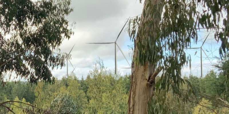
Virtual reality (VR) footage from the Yinnar Township can be viewed here (PASSWORD: DELBURN WIND FARM-IGNITION) showing the visibility of the turbines in the background. The views in the VR demonstrates the effectiveness of small trees and low shrubs at screening turbines which are approximately 4 kilometres away on elevated hills.
The result of the visual impact assessment from each town surrounding the project is set out below:
| Township | Nearest Turbine | Visual Impact |
|---|---|---|
| Yallourn | 13km SW (T03) | Negligible-Nil |
| Tyers | 21km SW (T01) | Negligible |
| Traralgon | 23km SW (T01) | Negligible |
| Churchill | 11.6km W (T16) | Negligible |
| Morwell | 10.2km SW (T01) | Negligible |
| Yinnar | 4.0km W (T14) | Low |
| Boolarra | 3.8km NW (T29) | Low-Negligible |
| Mirboo North | 7.3km NE (T33) | Low-Negligible |
| Thorpdale | 6.0km E (T24) | Negligible-Nil |
| Narracan | 2.8km E (T05) | Negligible-Nil |
| Coalville | 2.2km SE (T04) | Negligible-Nil |
| Moe | 8.8km S (T03) | Low-Negligible |
Eleven viewpoints within surrounding recreational trails, parks, and elevated lookouts have been assessed and it has been concluded that the visual impact on parks and recreational trails would be negligible. Outside of towns and built-up areas, walking trails tend to be in heavily vegetated areas such as the Lyrebird Forest Walk, Morwell National Park and the trail to Petersons lookout.
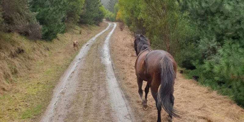
Views from residential dwellings have the greatest potential for visual impacts, and for residential occupiers the view to the wind turbines may not be just a glimpse or a 5-minute experience as they drive around the local road network, but potentially a permanent view from living areas or outside entertainment spaces of their homes.
Landholders that farm the land may also be impacted as they work on their property, however, these areas are not considered as sensitive as views from places of residence or attached private open space.
There are a total of 1567 dwellings within 6 kilometres of a proposed turbine and the SAA indicates the extent of theoretical visibility of the turbines from those dwellings. Across these dwellings, actual visibility and visual impact varies greatly.
There is greater theoretical visibility for areas east in the clear flat plain of Hazelwood and Yinnar. For those areas to the north of the project, visibility is largely defined by topography and a large number of dwellings will have little to no visibility at all.
The greatest potential for visual impacts is from individual residential dwellings located in close proximity to the Project but the range and nature of residential views will be dependent on the proximity and orientation of the dwelling towards the Project.
The visual impact from 20 residential dwellings ranging from 1.2-4.4 km from the nearest turbine have been included in the impact assessment and the impact ranges from Negligible to High with varying degrees of landscape mitigation considered to be possible, demonstrating the diversity of potential impacts in the context of this highly variable landscape.
If you would like to have a visual impact assessment completed at your home, please contact the project team.
The tallest component of the terminal station is the twin strain poles with an overall height of 45m, similar to the existing 220kV lattice supports.
Views to the terminal station locations will be screened by undulating topography and filtered by surrounding vegetation. Given the distance between this terminal station infrastructure and the closest residences is approximately 3km the terminal station will not be a dominating element in the view.
Perimeter screening may be provided if necessary, however it is likely that views would be effectively screened by the surrounding plantation.
Landscaping is one option available to mitigate views from residential properties in proximity to the proposed Wind Farm. In contrast to views from roads and working areas on farms and larger properties, views from dwellings and their immediate areas of private open space is relatively fixed, allowing planting to be carefully designed to screen or reduce the visual dominance of wind turbines through filtering of views.
However, not all landowners wish to screen views of turbines either through a preference to see the turbines, the potential to remove other views, or other aesthetic reasons. Therefore, landscape mitigation measures must be determined on a case-by-case basis in consultation with landholders to achieve optimal outcomes.
All wind farm projects within Victoria have a requirement to provide landscape mitigation for residential dwellings within an area where a high level of visual impacts is predicted. For recent projects, this distance has been set at 5 kilometres from an approved turbine (based upon the overall height of the proposed turbines). This requirement is typically incorporated as a permit condition setting out that the permit holder must implement measures to reduce the visual impact of turbines from the primary dwelling and attached outdoor areas of private open space.
An example of vegetation planting to assist with screening views to turbines is shown below. Alternatives include considered placement of single trees or clusters of trees to screen views to the nearest and/or most visually noticeable turbine
For dwellings located within a Bushfire Management Overlay (BMO) it will also be important to consider design requirements such as canopy separation, defendable space and distance from the dwelling. For these reasons, vegetation has been shown at varying distances from the dwelling assuming flat terrain.
Vertical view angles, taking into consideration the overall height of the turbines and the distance of the dwelling to the turbine, need to be considered when determining the height of the vegetation required to screen views. By analysing view angles for a height of 250m, it is possible to determine the approximate height that landscape mitigation would need to be to achieve to screen visual impacts at different distances from a residential dwellings.
An example of vegetation heights required based on the turbine being 1 kilometre away – the closest set back permissible under Victorian planning requirements – is shown below. Topography and elevation will also influence the landscaping requirements.
The Landscape and visual analysis has shown that the project is in an area that can accommodate the visual change of the Proposed Delburn Wind Farm and associated infrastructure and will not be detrimental to the views, character and amenity of the area within the viewshed of the Project.
The Project is proposed to be located entirely within an area that is used for managing timber and forestry plantations and will connect directly into an existing high voltage transmission line. The land to the north east of the site is occupied or in transition from open-cut coalmines and coalfired power stations with supporting infrastructure and transmission lines. The remaining land in this area, part of which is used for farming and agriculture is retained with a special use zone applied to areas reserved for future exploration and mining. The majority of the area to the east is used for farming, which is not a sensitive use. Views from these areas towards the project are influenced by existing vegetation within the surrounding road network, farming and conservation areas. Closer to the site and in the areas to the south and east comprises a folded and complex landscape where views change dramatically from clear long views to completely screened.
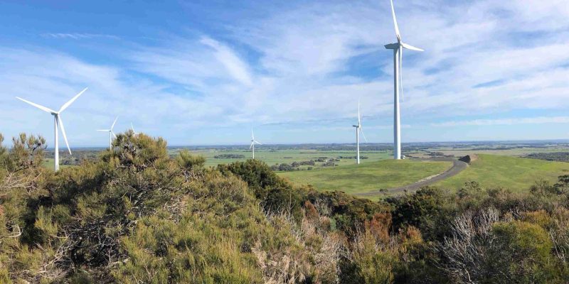
The greatest potential for visual impacts would be from individual dwellings located in close proximity to the Project. The majority of these dwellings are located in and around the same hills on which the turbines are located. The assessment has shown that views from these areas are diverse and visual impact changes dramatically over a short distance. There will be views from some dwellings that will have a high visual impact where neighbouring dwellings who are at a similar distance to the proposed turbines will have no visibility at all. This is due to the topography of the landscape in which the dwellings are located, the orientation and proximity to vegetation both within the private realm, roadsides, plantations and forestry areas.
This website will no longer be updated. For all future updates, please visit SEC’s website.